

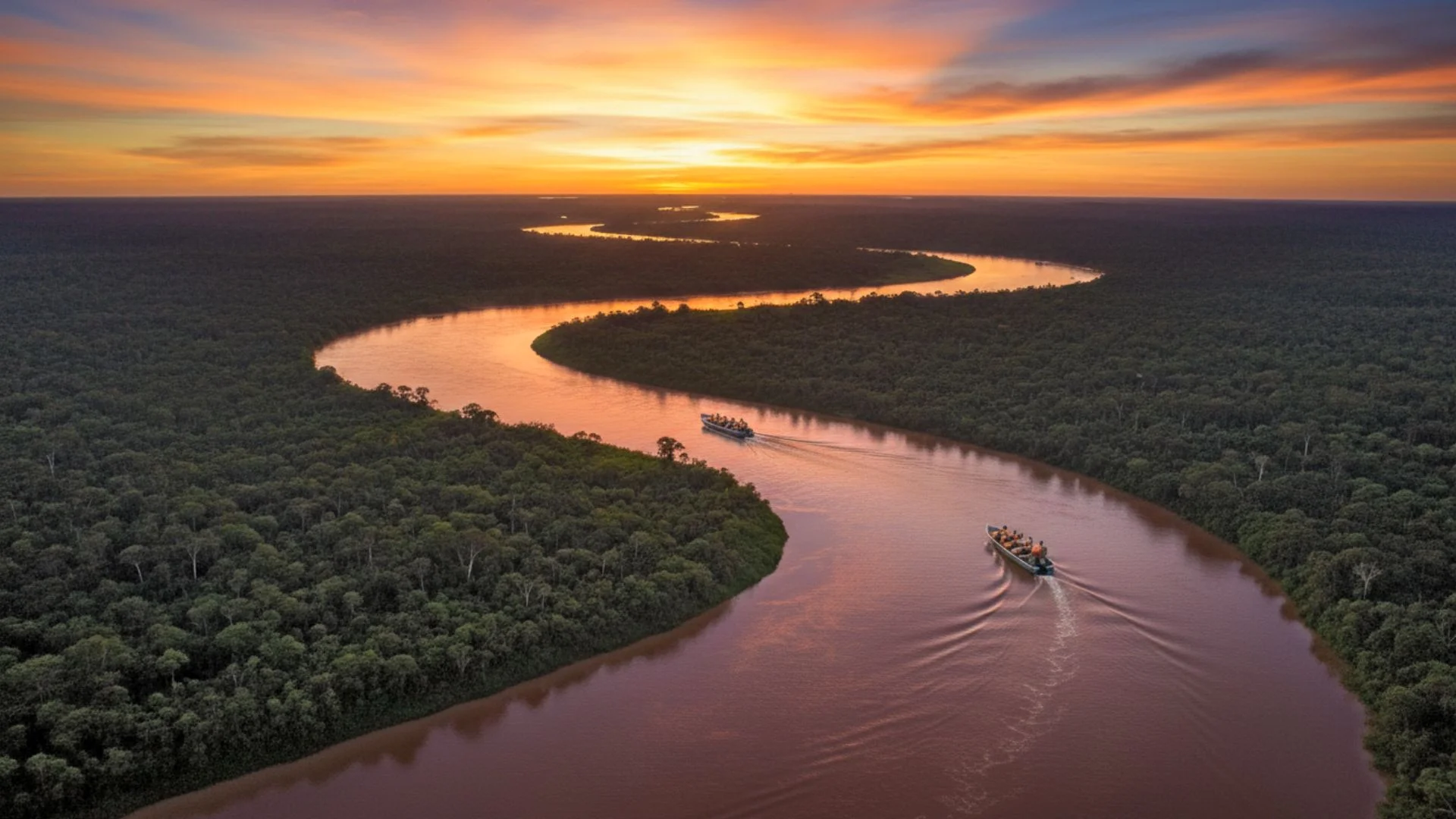
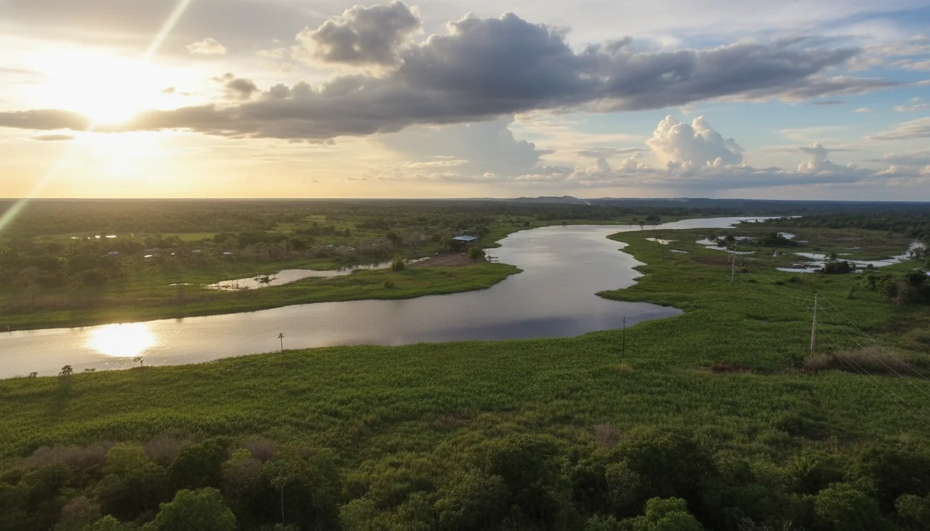
The rivers in Peru Amazon invite you to experience the rainforest from its most authentic, intimate, and vibrant side. As they flow continuously through endless jungles and connect deeply remote indigenous communities, these massive waterways breathe life into ever hanging landscapes and awaken the profound curiosity of every traveler. Navigating these waters allows you to discover unique sounds, aromas, and spectacular scenes that exist nowhere else on Earth.
Every journey along these powerful currents becomes a deep and profoundly real experience for nature lovers. Understanding the names of rivers in Peru and their unique geographical characteristics is the first step to planning an unforgettable expedition. From luxury cruises to rustic wooden canoes, exploring the giant rivers in Peru will transform your understanding of the Amazon basin and its incredible biodiversity.
List of Major Rivers in Peru Starting with the Amazon Basin
The main rivers in Peru flow predominantly through the immense Amazon rainforest, connecting isolated jungles, vibrant communities, and incredibly unique landscapes. Having a comprehensive list of major rivers in Peru is essential for any traveler looking to explore the deepest, most untouched parts of the South American continent safely and effectively.
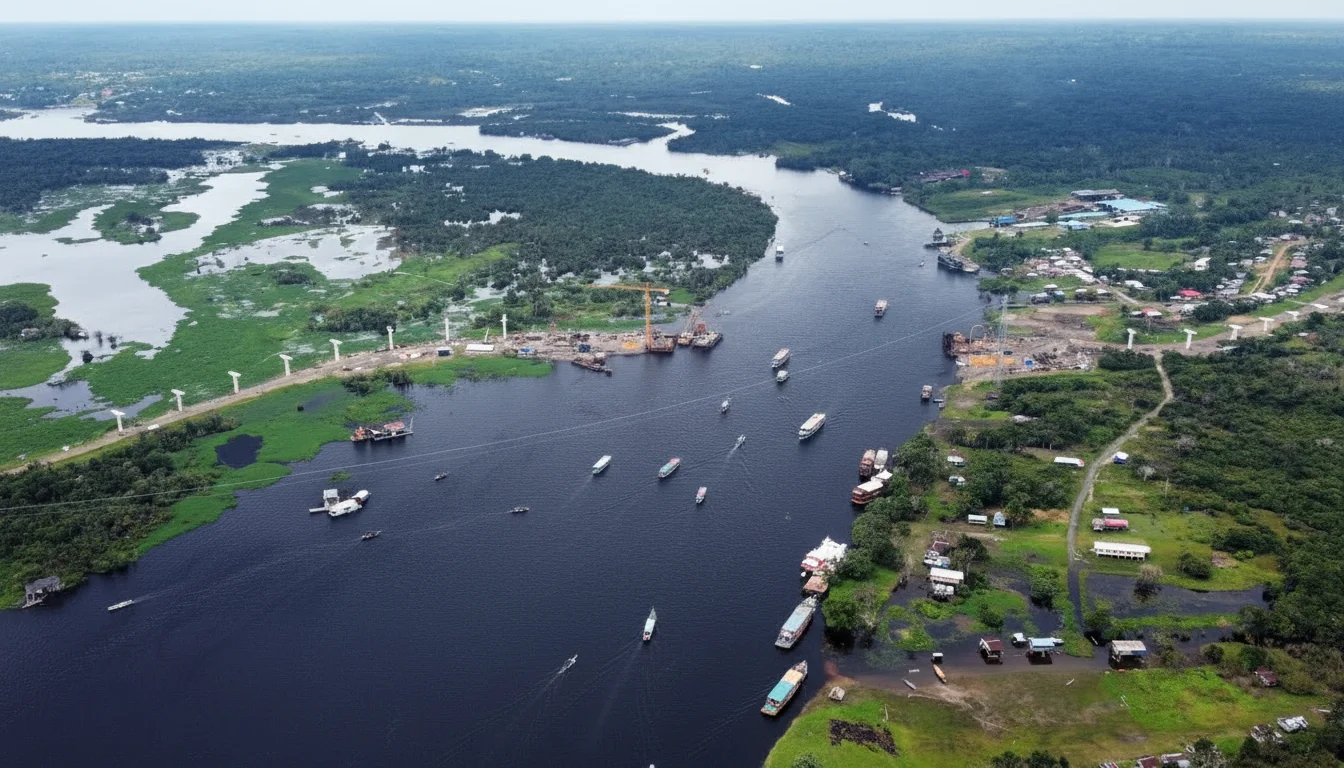
As you plan your journey, you will notice an intricate relationship between major cities and rivers in Peru, as urban centers like Iquitos and Pucallpa rely entirely on these waterways for survival and trade. These major rivers and bodies of water in Peru are the true lifeblood of the eastern provinces, providing food, transportation, and boundless opportunities for sustainable ecotourism.
Amazon River and the Largest Flow in the World
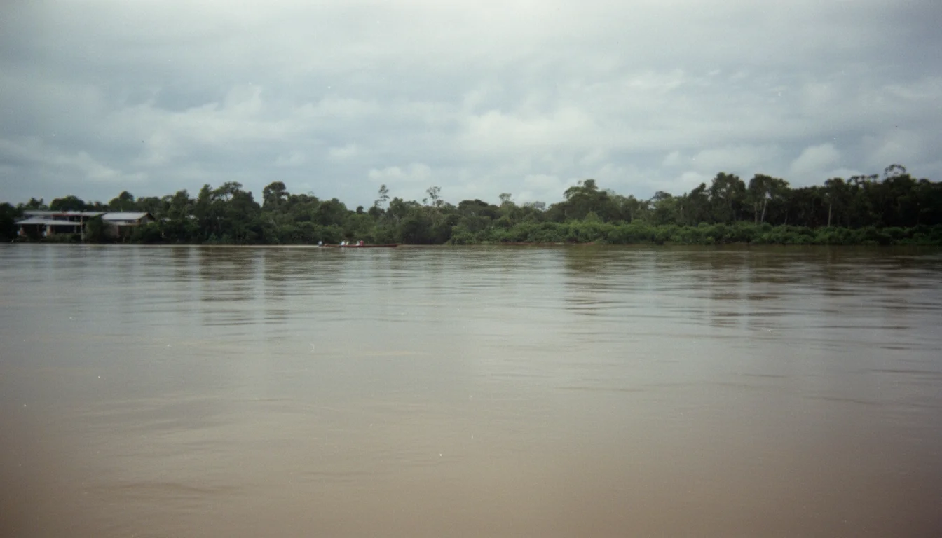
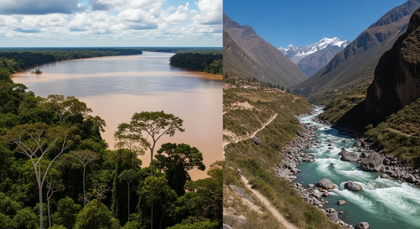
When exploring the rivers in Iquitos Peru, the Amazon River stands out as the undisputed crown jewel of the jungle and the entire world. It actively invites travelers to navigate its muddy waters and enjoy lush landscapes that change dramatically with every single mile. Natively originating at the snowy Mismi peak in the Arequipa region, it travels an astounding 7,062 kilometers through Peru, Colombia, and Brazil before finally emptying into the Atlantic Ocean.
This incredible waterway pours about 209,000 cubic meters of water per second into the ocean, making it the most voluminous river globally by a massive margin. Its average depth ranges from 20 to 50 meters, but during the intense high water season, it can reach up to 90 meters deep, showcasing its immense, terrifying power. It provides nearly 20 percent of the fresh water that reaches the global oceans and maintains routes that connect communities with cities like Iquitos, Nauta, and Caballococha.
Amazon River Measurements and Geographic Data
- Total Length 7,062 kilometers (longest in the world)
- Average Depth 20 to 50 meters (reaching up to 90 meters during the rainy season)
- Water Discharge 209,000 cubic meters per second
- Primary Source Nevado Mismi in the Arequipa region
- Navigability Highly navigable year round for massive cruise ships and cargo vessels
Ucayali River and the Strategic Route for the Central Jungle
If you closely observe how rivers in Peru flow north on a map, you will quickly notice the massive and powerful waterway known as the Ucayali River. The Ucayali River is formed by the turbulent union of the Tambo and Urubamba rivers, creating a highly strategic commercial route for the central jungle. It spans 1,771 kilometers with depths fluctuating between 5 and 25 meters, acting as a vital lifeline for bustling cities like Pucallpa, Contamana, and Requena.
This vibrant river actively dinamizes life and commerce in the central and lower jungle of Peru, allowing heavy cargo ships and small passenger boats to navigate its waters. It deeply connects travelers to the Shipibo Konibo indigenous peoples and other native communities who rely entirely on the river as their primary transportation route and main source of daily sustenance.
Ucayali River Measurements and Geographic Data
- Total Length 1,771 kilometers
- Average Depth 5 to 25 meters depending on the specific seasonal rainfall
- Formation Point The confluence of the Tambo River and Urubamba River
- Primary Flow Direction Northward toward the Loreto region
- Key Connected Cities Pucallpa, Contamana, and Requena
Maranon River and the Origins of the Amazon
The Marañón River is born high in Lake Lauricocha in the Huánuco region, flowing north and northeast with incredible speed and immense power. Its 1,414 kilometer length features depths between 10 and 30 meters, passing through dramatic, narrow canyons known locally as pongos which challenge even the most experienced navigators.
Eventually, the Marañón River beautifully converges with the Ucayali River near the town of Nauta in the Loreto region, a geographical milestone that officially forms the mighty Amazon River. The sheer force and dynamism of the Marañón make it a fascinating subject for geographical study and a vital waterway that shapes the diverse ecosystems of the northern Peruvian rainforest.
Maranon River Measurements and Geographic Data
- Total Length 1,414 kilometers
- Average Depth 10 to 30 meters in the main channels
- Primary Source Lake Lauricocha in the Huánuco high Andes
- Geographical Features Famous for deep, turbulent canyons known as pongos
- Final Destination Converges with the Ucayali River to form the Amazon River
Huallaga River and Traditional Jungle Legends
Descending rapidly from the high central Andes in the Pasco region, the Huallaga River flows north to eventually empty into the Marañón River in the Loreto region. Spanning over 1,138 kilometers, this river uniquely connects fertile agricultural valleys with the deep, humid Amazon basin. Its depth varies between 3 and 15 meters, making it heavily utilized for local farming transport and regional commerce.
It is considered one of the most popular rivers in Peru for exploring the high jungle landscape, especially around the vibrant cities of Tarapoto and Chazuta. The Huallaga River is deeply steeped in local folklore and mythology, including famous tales like the legend of the River Sirens in Chazuta, a story passed down through generations of local healers who deeply respect the river's unpredictable nature.
Huallaga River Measurements and Geographic Data
- Total Length 1,138 kilometers
- Average Depth 3 to 15 meters throughout the year
- Primary Source The central Andes within the Pasco region
- Key Tourist Areas Tarapoto, Chazuta, and Tingo Maria
- Final Destination Flows directly into the Marañón River
Napo River and the Connection to the Deep Jungle
Originating in the towering mountains of neighboring Ecuador, the Napo River crosses northeastern Peru before gracefully joining the mighty Amazon near the Colombian border. With 667 kilometers of its total 1,075 kilometer length flowing entirely through Peruvian territory, the Napo features navigational depths ranging between 6 and 20 meters.
This waterway is renowned for allowing extensive eco tours that perfectly combine raw nature observation with authentic Amazonian cultural immersion. Travelers on the Napo River frequently encounter isolated indigenous communities and have excellent opportunities to spot exotic wildlife far away from the heavy boat traffic of the main Amazon artery.
Napo River Measurements and Geographic Data
- Total Length 1,075 kilometers overall with 667 kilometers inside Peru
- Average Depth 6 to 20 meters ensuring stable navigation
- Primary Source The eastern slopes of the Ecuadorian Andes
- Main Ecosystems Primary flooded forests and dense rainforest reserves
- Tourism Style Deep jungle exploration and indigenous cultural encounters
Madre de Dios River Ecoadventure and Biodiversity
Flowing aggressively from the southern Andes in the Cusco region, the Madre de Dios River crosses through its namesake region before extending into Bolivia and Brazil, eventually feeding the massive Madeira River. Spanning approximately 1,150 kilometers, this vibrant river features depths varying from 4 to 15 meters depending entirely on the heavy tropical rainfall.
The Madre de Dios River is world famous for supporting extreme, unparalleled biodiversity and hosting some of the most stunning eco lodges in South America. It provides direct access to pristine protected areas like the Tambopata National Reserve, making it an absolute paradise for birdwatchers, wildlife photographers, and nature enthusiasts seeking jaguars and giant river otters.
Madre de Dios River Measurements and Geographic Data
- Total Length Approximately 1,150 kilometers crossing multiple countries
- Average Depth 4 to 15 meters
- Primary Source The snowy peaks of the Cusco Andean region
- Protected Areas Connects directly to the Tambopata National Reserve
- Wildlife Observation Premier destination for spotting macaws, giant otters, and caimans
Nanay River and Peaceful Jungle Tours
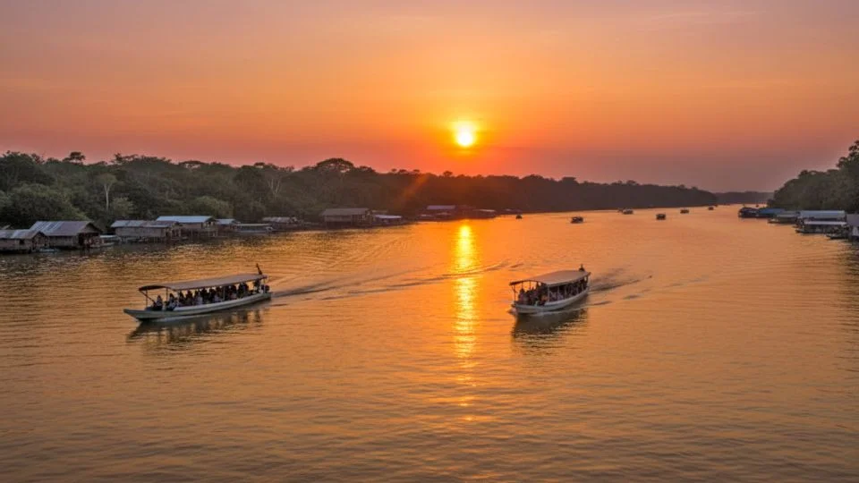
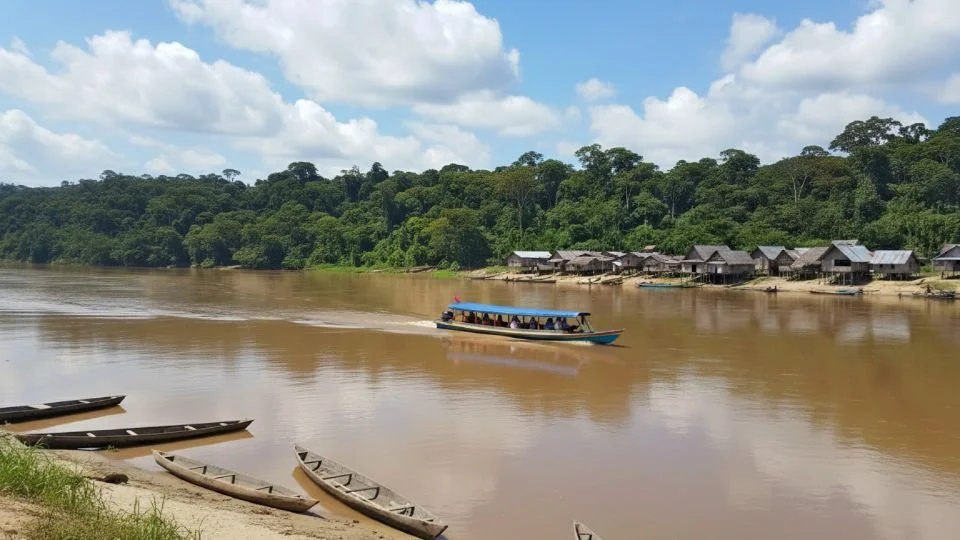
The Nanay River is located predominantly in the Loreto region and gracefully empties into the Amazon right next to the bustling, noisy city of Iquitos. Stretching 665 kilometers with highly manageable depths of 3 to 10 meters, it is heavily favored by tourists and locals alike who are looking for tranquil, slow paced river excursions.
Because its waters are distinctively dark due to natural tannins from decaying jungle leaves, the Nanay River offers a striking visual contrast when it finally meets the muddy, brown Amazon. Boat rides along this river often include stops at local butterfly farms, traditional indigenous villages, and vibrant floating markets where regional fruits and grilled fish are sold daily.
Nanay River Measurements and Geographic Data
- Total Length 665 kilometers
- Average Depth 3 to 10 meters creating a calm surface
- Water Type Blackwater river colored by organic tannins
- Key Activities Piranha fishing, visiting butterfly sanctuaries, and market tours
- Final Destination Meets the Amazon River directly at the city of Iquitos
Putumayo River Border Routes and Exploration
Born in the dense highlands of Colombia, the Putumayo River forms a massive, natural geopolitical border between Peru and Colombia, and later continues to separate Colombia and Brazil before completely integrating into the Amazon. Its total length reaches a staggering 1,813 kilometers, with a highly significant 1,380 kilometers acting as a crucial frontier for Peruvian territory.
With impressive depths that frequently exceed 15 meters, the Putumayo River offers vital fluvial routes that are of immense importance for both international transport and deep Amazonian exploration. It connects incredibly remote military outposts and indigenous communities that rely solely on the river for their survival, communication, and basic medical supplies.
Putumayo River Measurements and Geographic Data
- Total Length 1,813 kilometers overall
- Border Length 1,380 kilometers serving as the Peruvian frontier
- Average Depth Frequently exceeds 15 meters
- Primary Source The Colombian Andes mountains
- Geopolitical Importance Forms the massive natural border separating Peru, Colombia, and Brazil
Purus River and Isolated Amazon Communities
The Purús River originally forms in the southeastern Peruvian region of Ucayali and gently flows into Brazil until it inevitably merges with the Amazon. With 483 kilometers located strictly in Peru and navigational depths ranging from 5 to 20 meters, it is characterized by its extreme meandering and countless sharp curves.
This winding geographical nature allows intrepid travelers to discover some of the most isolated indigenous communities and untouched natural landscapes in the entire Amazon basin. The Purús River remains largely free from heavy commercial tourism, making it a pristine haven for serious researchers, biologists, and explorers seeking the true, wild heart of the rainforest.
Purus River Measurements and Geographic Data
- Length within Peru 483 kilometers before entering Brazil
- Average Depth 5 to 20 meters
- Primary Source The remote Ucayali region
- Geographical Features Extremely meandering with thousands of tight curves
- Tourism Level Very low commercial tourism, favoring scientific and isolated exploration
Itaya River and Urban River Life
The Itaya River is another vital, highly trafficked waterway in the Loreto region that directly empties into the Amazon right along the busy port of Iquitos. Although it is relatively short with a total extension of just 150 kilometers and depths remaining under 10 meters, it is incredibly important for the local urban water transport system.
The Itaya River essentially serves as the aquatic driveway for the city of Iquitos, filled daily with wooden canoes, buzzing motorized peke pekes, and floating houses. Exploring this river provides a fascinating, unfiltered glimpse into the daily, chaotic, and beautiful urban river life of the people who call the Peruvian Amazon their home.
Itaya River Measurements and Geographic Data
- Total Length 150 kilometers
- Average Depth Generally under 10 meters
- Location Focus Flows entirely within the Loreto region
- Primary Function Essential urban transport network and floating housing areas
- Final Destination Merges into the Amazon River at the Belen district of Iquitos
Discover How Many Rivers Are in Peru and Their Importance
If you are wondering how many rivers are in Peru, the country boasts an impressive network of over 1,000 distinct rivers distributed across three main drainage basins. These basins include the arid Pacific coast, the high altitude Lake Titicaca region, and the massive, sprawling Atlantic basin which forms the Amazon. This incredible abundance of fresh water shapes the dramatic landforms rivers lakes elevation in Peru, creating lush valleys in the desert and carving deep canyons in the mountains.
To truly understand what bodies of water or rivers are important in Peru, you must look directly at the eastern Atlantic basin. The rivers flowing into the Amazon cover nearly 60 percent of the entire national territory, serving as the primary highways for millions of people. These important rivers and lakes in Peru not only sustain thousands of unique animal species but also regulate the climate of the entire South American continent.
What Are the 3 Major Rivers in Peru
Travelers often ask what are the 3 major rivers in Peru when they first begin planning their complex Amazonian adventures. Because the country's hydrology is so vast and interconnected, identifying the absolute largest waterways helps visitors narrow down their travel itineraries and choose the best regions for wildlife observation.
If a geographer asks you to name three of the major rivers in Peru, the definitive and most accurate answer includes the Amazon River, the Ucayali River, and the Marañón River. These three massive bodies of water are considered the absolute largest in terms of historical significance, commercial navigation, and sheer water volume. When expanding this list to find the four longest rivers in Peru, experts typically add the Putumayo River, which forms a massive natural border in the northern jungle.
Rivers Beyond the Amazon Coast and Andes Mountains
While the lush Amazon basin holds the largest and most famous rivers in Peru, the arid coastal and towering Andean regions feature critically vital waterways of their own. The imposing Andes Mountains act as the great continental divide, determining exactly where and how water flows across the country. Understanding the major rivers and mountains in Peru is essential, as the snowmelt from these high peaks directly feeds both the Pacific valleys and the massive Amazon network.
These mountain waterways possess entirely different characteristics than their jungle counterparts. They often act as the fastest rivers in Peru due to the steep, dramatic drops and rocky gorges of the Andean cordillera. The relationship between rivers and mountains in Peru creates world class opportunities for extreme sports, including white water rafting on the Apurímac River, which is famously considered the true, most distant source of the Amazon itself.
Rivers in Lima Peru and Cusco Valleys
If you frequently ask the geography question lima peru located in valleys of which rivers, you will find that the desert coastal capital sits strategically in the intersecting valleys of the Rímac, Chillón, and Lurín rivers. The rivers in Lima Peru are absolutely essential for sustaining the lives of over 10 million urban residents, providing drinking water and agricultural irrigation to an environment that receives almost zero annual rainfall.
Further inland, if you explore what mountains and rivers are in Peru, you will find stunning, sacred waterways like the rivers in Cusco Peru. The Vilcanota Urubamba River is the absolute lifeblood of the famous Sacred Valley of the Incas, cutting violently through the mountains to create the exact gorge that houses the legendary citadel of Machu Picchu before it eventually softens and enters the jungle.
Geography of High Jungle Versus Low Jungle Rivers
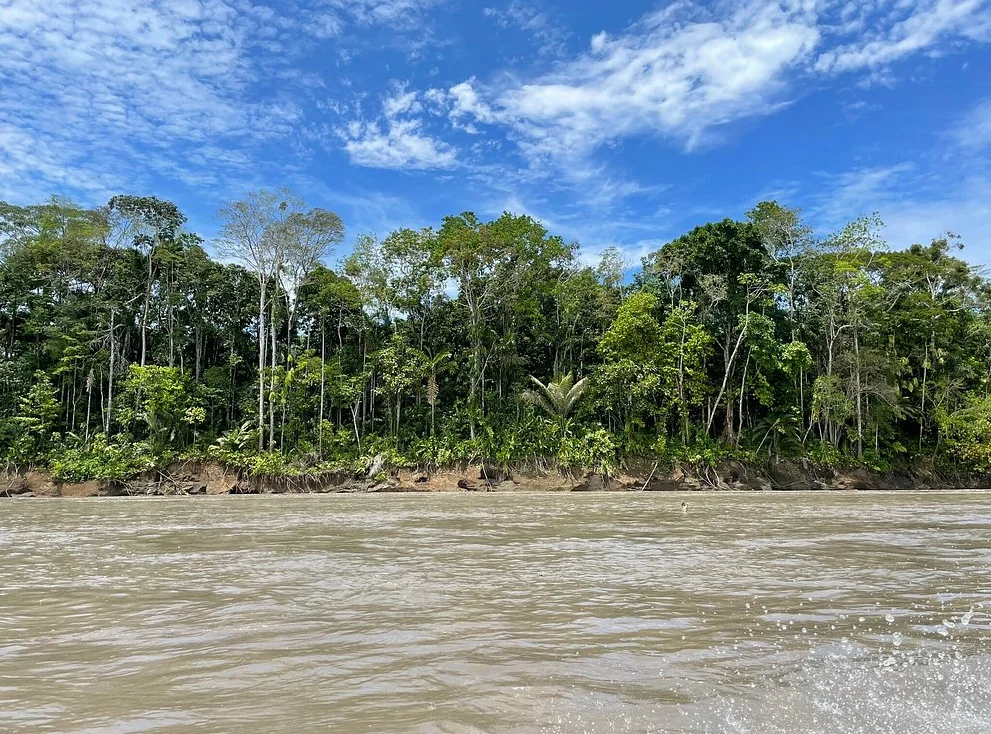
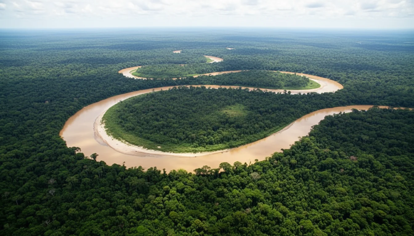
When you closely examine a major rivers in peru map, you will instantly notice a stark geographical difference in how water behaves based entirely on its elevation. The high jungle rivers, born closer to the mountains, descend incredibly rapidly through narrow, rocky canyons, making their courses turbulent and incredibly challenging for continuous boat navigation. In stark contrast, low jungle rivers flow lazily through wide, flat plains, forming sweeping curves that allow for massive cruise ships to pass easily.
The water temperature of rivers in Peru also shifts drastically depending on the specific altitude of the jungle. In the high jungle, the water remains relatively cool, ranging from 18 degrees to 23 degrees Celsius with fast, aggressive currents. As you travel down into the low jungle plains, the temperature warms significantly, varying between 24 degrees and 28 degrees Celsius with very slow, peaceful currents year round, completely transforming the aquatic ecosystem and the types of fish that survive there.
Environmental Challenges and the Gold Rivers in Peru
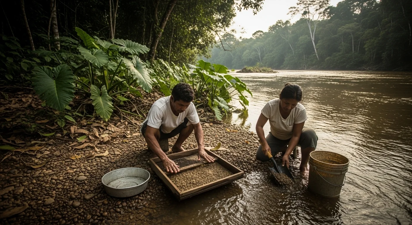
When extensively researching what are some major rivers in Peru, you may sadly come across the tragic terms gold rivers in Peru or rivers of gold in Peru. Unfortunately, these names do not refer to beautiful sunsets, but to the devastating practice of illegal gold mining, particularly highly concentrated in the Madre de Dios region. This unregulated, destructive activity uses heavy amounts of mercury, heavily polluting the water, mutating aquatic life, and endangering the health of riverine indigenous communities.
Travelers sometimes ask if there are any uncharted salt water rivers in Peru hidden deep in the jungle. The absolute answer is no, as the Amazon and its massive tributaries are strictly, entirely freshwater ecosystems. However, the deep jungle does hide highly unique geological anomalies that defy logic, such as the famous Boiling River of Mayantuyacu in Huánuco, where geothermal heat causes the river water to literally reach boiling temperatures, cooking anything that falls in.
Tourism Activities and Exploring Famous Rivers in Peru
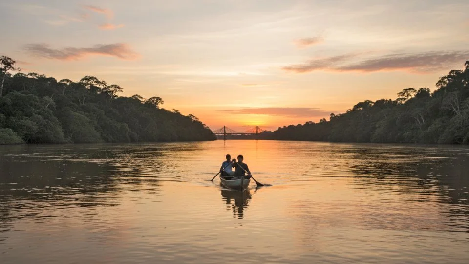
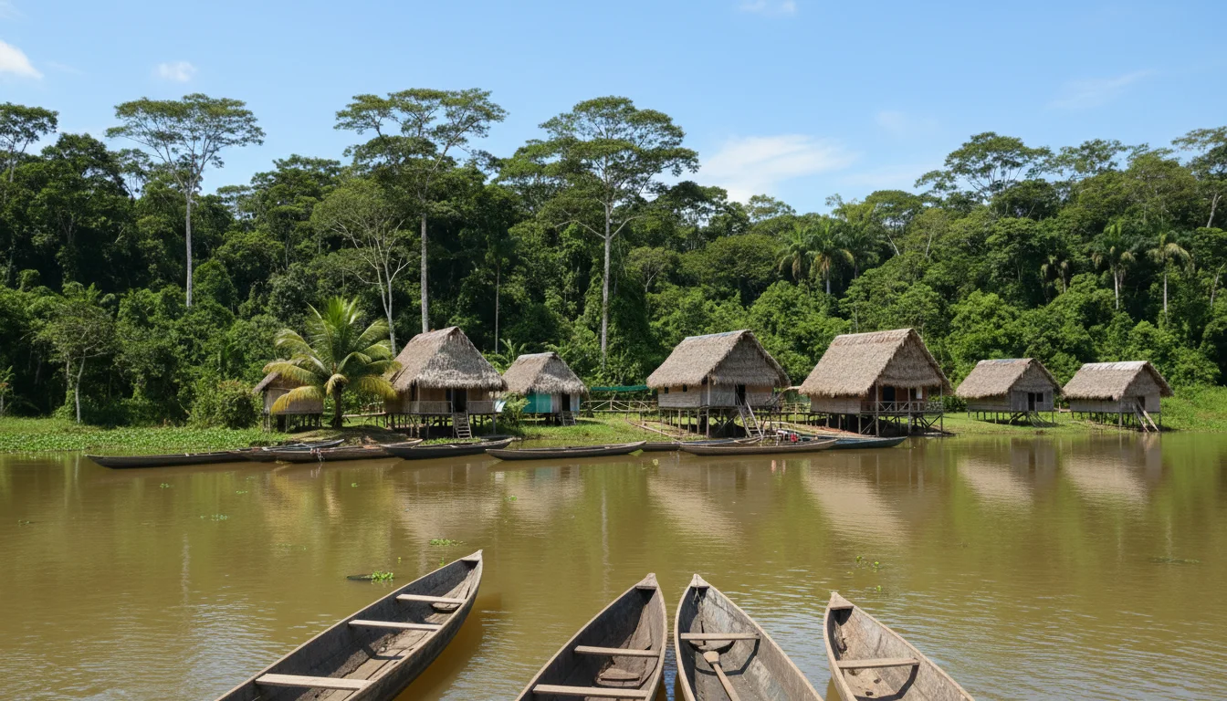
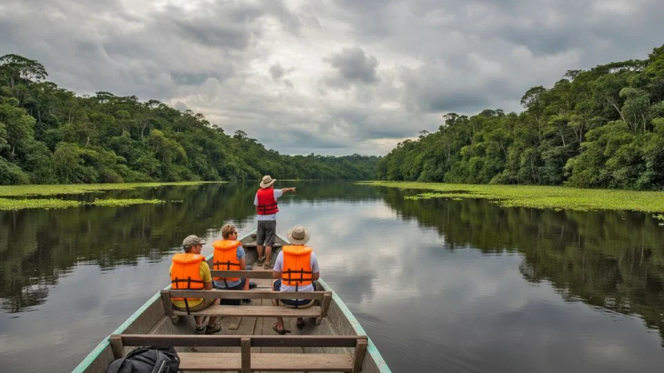
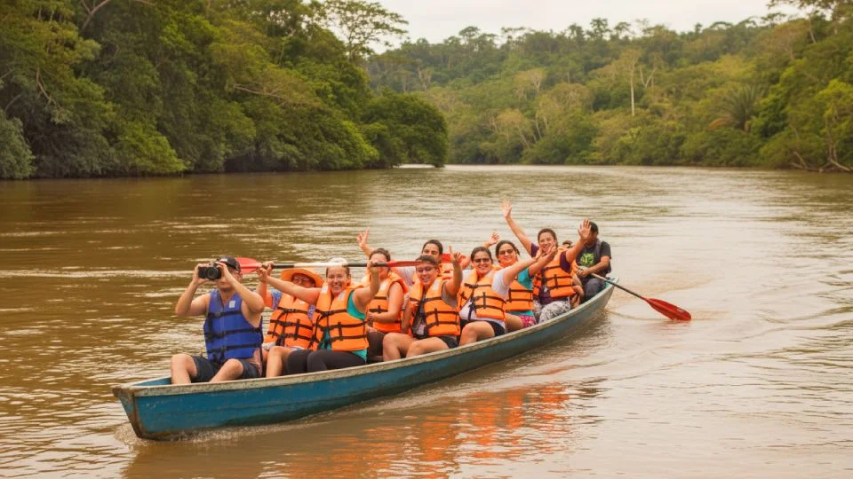
The Peruvian Amazon offers profoundly unique and thrilling adventures for anyone willing to explore the major rivers and lakes in Peru. From taking luxurious, multi day cruises down the Amazon River to staying in remote, eco friendly wooden lodges on the banks of the Madre de Dios, the tourism infrastructure is designed to safely immerse you in the wildest biodiversity on the planet. Specialized guided excursions allow you to safely walk through flooded forests, spot pink river dolphins, and observe hundreds of exotic bird species.
While safely navigating these most important rivers in Peru, travelers also have the incredible opportunity to taste authentic, fresh river gastronomy. You can enjoy traditional dishes like juane, spicy Amazonian ceviche, and patarashca wrapped in fresh bijao leaves. Engaging with the local communities living along these important rivers in Peru not only provides you with delicious food but also supports sustainable, conscious tourism that actively helps protect these vital waterways from environmental destruction.
Travel Tips and How to Navigate Giant Rivers in Peru
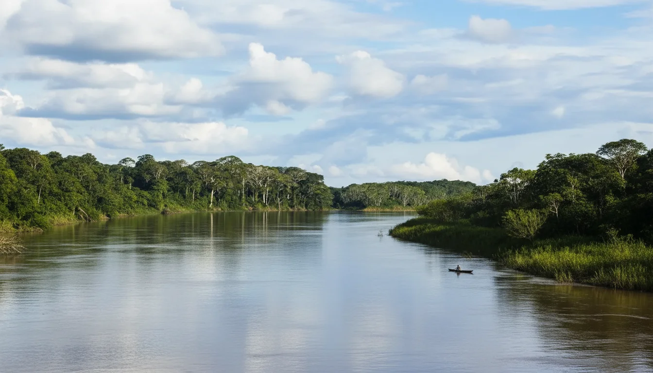
Before you pack your bags to explore what are the major rivers in Peru, you must understand the deep seasonal changes of the Amazon basin. The high water season, which runs from November to April, causes the giant rivers in Peru to swell massively, flooding the surrounding forests. This is actually the best time for navigation, as boats can glide directly through the tree canopy, allowing you to easily spot monkeys and sloths hiding in the high branches.
Conversely, the dry season from May to October causes the river levels to drop significantly, exposing massive, beautiful white sand river beaches. This season is highly ideal for those who prefer jungle trekking on solid ground and observing migratory birds. Regardless of the season, you should always travel with formal, highly accredited tour operators, carry strong insect repellent, and ensure you have received a Yellow Fever vaccination before entering the deep jungle territories.
Frequently Asked Questions About Rivers in Peru
Is it safe to navigate the rivers in the Peruvian Amazon without putting yourself at risk? Yes, navigating the rivers is incredibly safe provided you travel exclusively with formal tour operators and accredited, experienced local guides. These registered companies strictly comply with necessary safety protocols, utilize proper life jackets, and deeply understand the unpredictable river conditions based on the changing seasons.
What vaccines do I need before traveling to the remote rivers of the Amazon basin? It is highly recommended to receive the Yellow Fever vaccine at least ten days before your trip into the Amazon. Additionally, you should consult with a travel clinic or your doctor regarding malaria prophylaxis, Hepatitis A, and tetanus shots to ensure you remain completely healthy while exploring the remote jungle waterways.
How many days are recommended for a complete experience?
Ideally, you should allow 3 to 4 days for a basic experience. However, if you want to explore more deeply, observe wildlife, and visit communities, consider 5 to 7 days.
Is it safe to navigate the rivers of the Peruvian jungle?
Yes, as long as you travel with formal operators and accredited guides. Registered companies comply with safety protocols, use life jackets, and are familiar with river conditions depending on the season.
What vaccinations do I need before traveling?
The yellow fever vaccine is recommended at least 10 days before travel. In addition, it is advisable to consult a health center about prevention against hepatitis A, tetanus, and other diseases according to your medical history.
Is there cell phone reception or internet access?
In cities such as Iquitos or Puerto Maldonado, there is reception. However, in remote lodges, access is often limited or non-existent, allowing you to disconnect and fully enjoy the surroundings.
Is it necessary to book a tour or can I go on my own?
It is recommended to book a formal tour. Local guides know the routes, river levels, and necessary safety measures, especially in remote areas.
What type of accommodation is available near the rivers?
You will find everything from eco-lodges in the middle of the jungle to more comfortable accommodations in Amazonian cities. Lodges usually include meals and guided excursions.